What a day! Eight hours of fast walking—Ok, no serious elevation, but still. It started out like this: For the first section, take the boring route or the suggested diversion. Instructions for the diversion: Head NE from Wilderhope Manor to Pilgrim's Cottage, turn right and take the forest track across Mogg Forest, exit at a stile and cross a field, on reaching a stream turn right and continue beside small lakes to reach Easthope Village. From here, you can ascend to Wenlock Edge and the Shropshire Way once more. I studied the route on the OS map and decided to give it a go.
My first mistake should have been a warning: I started out to Pilgrim's Cottage by going though a gate....did not need to go through gate, but that error became clear fairly soon. Then, in Mogg Forest the track split; I took the wrong leg of the V. After the small lakes there was a ginormous barley field with no crossing in the correct direction. After several failed attempts to get it right, I decided to bushwhack through that damn barley for a good quarter mile. (One is not supposed to do this when crops are growing.) Finally, at Easthope village, I could not figure out how to ascend to Wenlock Edge, so I took the road for some distance thus sort of negating the beauty of the diversion (it was really nice!)
The B3421, not so much:
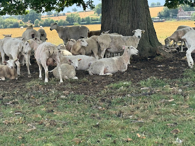
Of course there were sheep:
And other beasties:
And remnants of a bygone era:
And from the present era:
There were a few concerns, such as wondering whether one was to exit the field though that little door affair behind a fence and under a big fallen tree:
(No.)
And making sure to stay right on the derech (path) and veer neither to the right nor to the left:
To avoid the electrified bands connecting the posts. (One could easily crawl under, though.)
One totally adorable town en route is Much Wenlock. It is sort of a mini Ludlow, but due to the extra distance the early errors of my ways cost me, I figured I should just soldier on, and a good thing, too, because the worst was yet to come. Oh, Much is famous for:
I knew that there was a diversion fairly near to Ironbridge. What I had not figured was how poorly the diversion would be marked. As I was going where the diverting sign pointed, I encountered a couple walking their dog. "I am trying to get to Ironbridge; can you help me find the best way?" The guy offered two possibilities; I settled on the one that had me continue the way I was going and then to follow the purple arrows and son on.
A while after the purple arrow turn off, I was not happy with the way things looked. Another man walking his dog appeared; I asked him for directions. I would have been wandering in these very dark dark and eerie woods for days had I listened to him but, pointing to a yellow road on the map, he did tell me, "You have to get to this road here." "Oy!" That was all the way back where the first guy told me to follow the purple arrows. All this was a good hour of extra walking. Thank God the walking itself was not difficult. Being lost and not being able to figure it out, is very stressful.
Bed and Breakfast in Ironbridge is lovely. BUT you have to climb a huge, as in very large, flight of stairs to get here. I so did not want to descend and reascend in order to go to the Co-Op, so when Julie, the owner, announced that she was going to buy fruit and vegetables, I asked if I could go along. Let's put it this way, as mediocre as the Co Op is, it is better than the shoppee we went to, but I made do with a crappy sandwich and some excellent blueberries. Tomorrow, I will improve upon the main course!


No comments:
Post a Comment